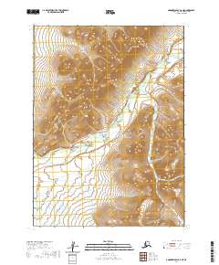
2020 Map of Goodnews Bay D-6 NE
USGS Topo · Published 2020About this map
Great Ridge dominates the northern landscape of this Bethel Census Area territory, where the topography rises sharply above the surrounding drainages. The Middle Fork Eek River carves a winding path through the center and northeast sections of the quadrangle, while the Ugaklik River appears in the southwest corner. This 2020 edition provides a clear record of the watershed patterns and land divisions within the t2s r68w and t3s r68w townships. The map is defined by its lack of infrastructure, focusing instead on the hydrological network and the high-altitude terrain of the ridge system, serving as a primary document for those studying the uninhabited interior of this part of Alaska.
Find a feature on this map
8 named features on this map. Tap any name to fly to it.
Don’t see what you’re looking for? This feature index may not catch every label — zoom into the map to look around manually.
Map Details
Editions of this 2020 Goodnews Bay D-6 NE Map
This is the sole edition of this map. No revisions or reprints were ever made.
Other maps of this area

1950 · Bethel
USGS Topo · 1:250,000

1951 · Goodnews
USGS Topo · 1:250,000

1954 · Bethel A-5
USGS Topo · 1:63,360

1954 · Goodnews D-6
USGS Topo · 1:63,360

1954 · Goodnews D-5
USGS Topo · 1:63,360

1954 · Bethel A-6
USGS Topo · 1:63,360
1964 · Bethel A-6
USGS Topo · 1:63,360

1979 · Goodnews Bay
USGS Topo · 1:250,000

1980 · Bethel
USGS Topo · 1:250,000
2017 · Bethel A-6 SW
USGS Topo · 1:25,000