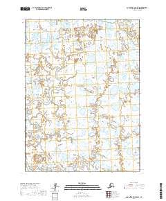
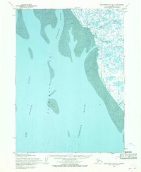
2017 Map of Goodnews Bay D-8 NW
USGS Topo · Published 2017About this map
Meandering waterways define this landscape in the Bethel Census Area, where the North Branch Warehouse Creek and South Branch Warehouse Creek wind through a complex network of wetlands and small lakes. This 2017 survey shows the intricate drainage patterns of the Alaskan tundra, highlighting how the N Br Warehouse Cr and its southern counterpart dominate the local hydrology. Smaller tributaries like Tungak Cr feed into the system, which is part of a larger basin that reflects the shifting natural environment of the Goodnews Bay region. The absence of roads or permanent settlements underscores the isolation of this terrain, where the United States Geological Survey has mapped the precise flow of the S Br Warehouse Cr and surrounding water bodies for environmental and navigational study.
Find a feature on this map
9 named features on this map. Tap any name to fly to it.
Don’t see what you’re looking for? This feature index may not catch every label — zoom into the map to look around manually.
Map Details
Editions of this 2017 Goodnews Bay D-8 NW Map
This is the sole edition of this map. No revisions or reprints were ever made.
Other maps of this area

1950 · Bethel
USGS Topo · 1:250,000

1951 · Kuskokwim Bay
USGS Topo · 1:250,000

1951 · Goodnews
USGS Topo · 1:250,000

1951 · Baird Inlet
USGS Topo · 1:250,000
1954 · Bethel A-8
USGS Topo · 1:63,360

1954 · Baird Inlet
USGS Topo · 1:250,000

1954 · Kuskokwim Bay
USGS Topo · 1:250,000
1954 · Baird Inlet A-1
USGS Topo · 1:63,360
1954 · Goodnews D-8
USGS Topo · 1:63,360
1954 · Kuskokwim Bay D-1
USGS Topo · 1:63,360