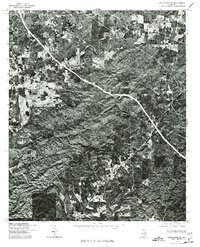
1975 Map of Goodwater SW
USGS Topo · Published 1977About this map
Stewartville and the surrounding woodlands of Coosa County are captured here in high-contrast detail through a 1975 aerial orthophotograph. This specialized survey, produced by the Geological Survey and the Soil Conservation Service, uses scanned photoimagery rather than traditional topographic contour lines to document the land. The resulting view emphasizes the dense forest cover and the winding road networks that connect Hollins in the northeast to Hanover in the south. The imagery clearly delineates the cleared patches of agricultural land and timber harvesting sites, revealing the mid-1970s land-use patterns across this rural Alabama landscape. It provides a unique visual record of property boundaries and vegetation density that traditional line maps often omit.
Find a feature on this map
3 named features on this map. Tap any name to fly to it.
Don’t see what you’re looking for? This feature index may not catch every label — zoom into the map to look around manually.
Map Details
Editions of this 1975 Goodwater SW Map
This is the sole edition of this map. No revisions or reprints were ever made.
Other maps of this area

1890 · Talladega
USGS Topo · 1:125,000

1892 · Talladega
USGS Topo · 1:125,000

1901 · Wetumpka
USGS Topo · 1:125,000

1903 · Wetumpka
USGS Topo · 1:125,000

1915 · Gantts Quarry
USGS Topo · 1:48,000

1917 · Gantts Quarry
USGS Topo · 1:62,500

1944 · Goodwater
USGS Topo · 1:62,500

1947 · Goodwater
USGS Topo · 1:62,500

1953 · Montgomery
USGS Topo · 1:250,000

1953 · Birmingham
USGS Topo · 1:250,000