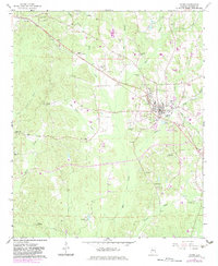
1967 Map of Gordo
USGS Topo · Published 1983About this map
Gordo serves as the primary hub of activity in this part of Pickens County, centered on the Illinois Central Gulf railroad line. The surrounding landscape is characterized by a dense network of rural churches and family cemeteries, reflecting the generational settlement patterns of western Alabama. From Hargrove Church in the north to Ebenezer Church in the south, these landmarks anchor the community alongside natural features like Bear Creek and Lubbub Creek.
Find a feature on this map
48 named features on this map. Tap any name to fly to it.
Don’t see what you’re looking for? This feature index may not catch every label — zoom into the map to look around manually.
Map Details
Editions of this 1967 Gordo Map
2 editions found
Other maps of this area

1953 · Birmingham
USGS Topo · 1:250,000

1953 · West Point
USGS Topo · 1:250,000

1956 · Birmingham
USGS Topo · 1:250,000

1957 · Birmingham
USGS Topo · 1:250,000

1958 · West Point
USGS Topo · 1:250,000

1963 · West Point
USGS Topo · 1:250,000

1967 · Carrollton
USGS Topo · 1:24,000

1967 · Brownville
USGS Topo · 1:24,000

1967 · Gordo
USGS Topo · 1:24,000
1967 · Palmetto
USGS Topo · 1:24,000