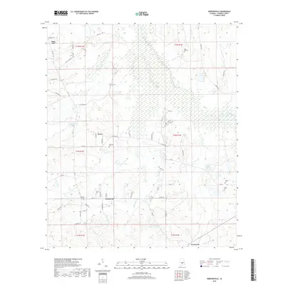
2018 Map of Gordonsville
USGS Topo · Published 2018About this map
Gordonsville and the town of Mosses anchor this rural landscape in central Lowndes County, characterized by a dispersed network of family and community burial grounds. These sites, including Bogahoma Cem, Rudolph Hill Cem, and Hope Well Cem, are scattered across a terrain of subtle elevation changes and agricultural drainage features. Water management is evident through landmarks like Kellys Ditch, which cuts through the central sections, and several localized ponds such as Hollidays Pond and Martins Lake.
Find a feature on this map
63 named features on this map. Tap any name to fly to it.
Don’t see what you’re looking for? This feature index may not catch every label — zoom into the map to look around manually.
Map Details
Editions of this 2018 Gordonsville Map
This is the sole edition of this map. No revisions or reprints were ever made.
Other maps of this area

1953 · Montgomery
USGS Topo · 1:250,000

1956 · Montgomery
USGS Topo · 1:250,000

1957 · Montgomery
USGS Topo · 1:250,000

1957 · Autaugaville
USGS Topo · 1:62,500

1957 · Benton
USGS Topo · 1:62,500

1957 · Braggs
USGS Topo · 1:62,500

1975 · Benton SE
USGS Topo · 1:24,000

1975 · Autaugaville SW
USGS Topo · 1:24,000

1975 · Autaugaville SE
USGS Topo · 1:24,000
1981 · Calhoun
USGS Topo · 1:24,000