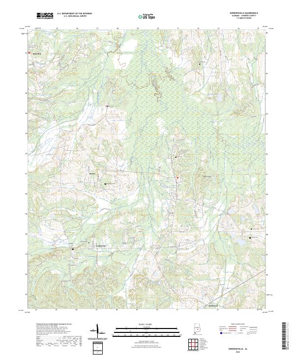
2024 Map of Gordonsville
USGS Topo · Published 2024About this map
Mosses and Gordonsville anchor this contemporary portrait of rural Lowndes County, where the landscape is defined by its long-standing family cemeteries and a complex drainage network. The area’s heritage is preserved in sites like Gordon Cem, Hope Well Cem, and Bogahoma Cem, which remain significant landmarks for local genealogists. The terrain transitions from higher points like Hicks Hill and Rudolph Hill toward lower marshy ground and man-made waterways. Significant local water management is evident through the path of Kellys Ditch, which cuts through the central townships. The map documents the persistent rural road network, from Mary J Jackson Rd to Co Rd 17, reflecting a community that has maintained its small-town character while remaining connected to the broader agricultural region through settlements like Millers Ferry and Beechwood.
Find a feature on this map
62 named features on this map. Tap any name to fly to it.
Don’t see what you’re looking for? This feature index may not catch every label — zoom into the map to look around manually.
Map Details
Editions of this 2024 Gordonsville Map
This is the sole edition of this map. No revisions or reprints were ever made.
Other maps of this area

1953 · Montgomery
USGS Topo · 1:250,000

1956 · Montgomery
USGS Topo · 1:250,000

1957 · Montgomery
USGS Topo · 1:250,000

1957 · Autaugaville
USGS Topo · 1:62,500

1957 · Benton
USGS Topo · 1:62,500

1957 · Braggs
USGS Topo · 1:62,500

1975 · Benton SE
USGS Topo · 1:24,000

1975 · Autaugaville SW
USGS Topo · 1:24,000

1975 · Autaugaville SE
USGS Topo · 1:24,000
1981 · Calhoun
USGS Topo · 1:24,000