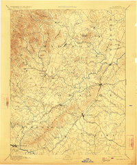
1892 Map of Gordonsville
USGS Topo · Published 1923About this map
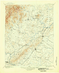
The Virginia Midland Railroad and the Chesapeake and Ohio Railroad converge at the foot of the Southwest Mountain range, establishing this region as a critical transportation corridor in the late 19th century. W. T. Griswold’s survey captures the Piedmont’s transition from the heights of the Blue Ridge and German Ridge down into the agricultural valleys defined by the Rapidan River and Robinson River. This map details the established county seats of Madison, Orange, and Charlottesville, along with specialized rail stops like Madison Run Station and Rapidan Station. The distribution of smaller settlements such as Criglersville, Wolftown, and Liberty Mills reveals a landscape organized around river fords, grain processing at sites like Banks Mill, and the emerging commercial importance of the rail lines.
Find a feature on this map
77 named features on this map. Tap any name to fly to it.
Don’t see what you’re looking for? This feature index may not catch every label — zoom into the map to look around manually.
Map Details
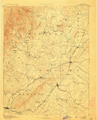
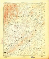
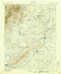
Editions of this 1892 Gordonsville Map
6 editions found
Other maps of this area

1887 · Spottsylvania
USGS Topo · 1:125,000

1890 · Goochland
USGS Topo · 1:125,000

1891 · Palmyra
USGS Topo · 1:125,000

1892 · Buckingham
USGS Topo · 1:125,000

1892 · Spottsylvania
USGS Topo · 1:125,000

1892 · Goochland
USGS Topo · 1:125,000

1892 · Woodstock
USGS Topo · 1:125,000

1892 · Gordonsville
USGS Topo · 1:125,000

1892 · Harrisonburg
USGS Topo · 1:125,000

1893 · Luray
USGS Topo · 1:125,000