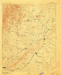
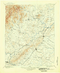
1892 Map of Gordonsville
USGS Topo · Published 1907About this map
The Virginia Midland Railroad and the Chesapeake and Ohio Railroad converge at the critical rail hubs of Orange and Gordonsville, anchoring the late 19th-century economy of the Virginia Piedmont. This reconnaissance survey, conducted by W. T. Griswold, details a landscape of transitioning transport, where older water-powered sites like Liberty Mills on the Rapidan River coexist with new rail-side depots like Rapidan Station and Madison Run Station.
Find a feature on this map
82 named features on this map. Tap any name to fly to it.
Don’t see what you’re looking for? This feature index may not catch every label — zoom into the map to look around manually.
Map Details
Editions of this 1892 Gordonsville Map
6 editions found
Other maps of this area

1887 · Spottsylvania
USGS Topo · 1:125,000

1890 · Goochland
USGS Topo · 1:125,000

1891 · Palmyra
USGS Topo · 1:125,000

1892 · Buckingham
USGS Topo · 1:125,000

1892 · Spottsylvania
USGS Topo · 1:125,000

1892 · Goochland
USGS Topo · 1:125,000

1892 · Woodstock
USGS Topo · 1:125,000

1892 · Gordonsville
USGS Topo · 1:125,000

1892 · Harrisonburg
USGS Topo · 1:125,000

1893 · Luray
USGS Topo · 1:125,000