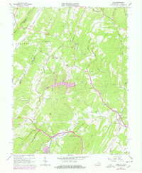
1965 Map of Gore
USGS Topo · Published 1978About this map
Gore and the neighboring hills of Frederick County appear here in the mid-1960s, a landscape defined by ridges like Bear Mountain and the deep cut of the Winchester and Western Railroad. The settlement pattern follows the valley floors, with small crossroads such as Cross Junction and Whitacre serving as local hubs. Traces of early frontier passage remain visible through the labeling of the Old Braddock Road, which intersects with modern routes like Acorn Hill Road.
Find a feature on this map
46 named features on this map. Tap any name to fly to it.
Don’t see what you’re looking for? This feature index may not catch every label — zoom into the map to look around manually.
Map Details
Editions of this 1965 Gore Map
4 editions found
Other maps of this area

1894 · Winchester
USGS Topo · 1:125,000

1914 · Gerrardstown
USGS Topo · 1:48,000

1916 · Gerrardstown
USGS Topo · 1:62,500

1916 · Capon Bridge
USGS Topo · 1:62,500

1923 · Middletown
USGS Topo · 1:62,500

1923 · Capon Bridge
USGS Topo · 1:62,500

1937 · Capon Bridge
USGS Topo · 1:48,000

1937 · Gerrardstown
USGS Topo · 1:48,000

1937 · Middletown
USGS Topo · 1:48,000

1938 · Winchester
USGS Topo · 1:48,000