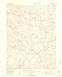
1956 Map of Gore Pass
USGS Topo · Published 1958About this map
Gore Pass serves as the central landmark for this high-altitude landscape where the Routt National Forest and Arapaho National Forest meet. The 1956 field check records a mid-century period of active timber and ranching operations, visible through features like the Strutsell Sawmill and a dedicated Lumber Camp near Red Dirt Creek. The terrain is characterized by a dense network of watercourses, including Milk Creek and Silver Creek, which feed into numerous Beaver Ponds across the high plateaus.
Find a feature on this map
72 named features on this map. Tap any name to fly to it.
Don’t see what you’re looking for? This feature index may not catch every label — zoom into the map to look around manually.
Map Details
Editions of this 1956 Gore Pass Map
4 editions found
Other maps of this area

1933 · Mt. Powell
USGS Topo · 1:48,000

1940 · Mount Powell
USGS Topo · 1:62,500

1954 · Craig
USGS Topo · 1:250,000

1956 · Lake Agnes
USGS Topo · 1:24,000

1956 · Kremmling
USGS Topo · 1:62,500

1956 · Whiteley Peak
USGS Topo · 1:24,000

1956 · Walton Peak
USGS Topo · 1:24,000

1956 · Gore Pass
USGS Topo · 1:62,500

1956 · Hyannis Peak
USGS Topo · 1:62,500

1956 · Rabbit Ears Peak
USGS Topo · 1:62,500