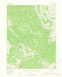
1956 Map of Gore Pass
USGS Topo · Published 1963About this map
Gore Pass and Lynx Pass serve as the primary topographic crossings in this mid-century survey of the high country spanning the boundary of Routt Co and Grand Co. The landscape is defined by the high-elevation transition between the Routt National Forest and Arapaho National Forest, where a network of seasonal camps and ranching outposts supported the local economy. Evidence of the timber and ranching industry is visible at the Strutzel Sawmill, Lumber Camp, and several family-named holdings such as Snowshoe Ranch and Pinney Ranch. Water management is central to the area, documented by the Mc Mahon Reservoir and the Dirt Ditch, which redirect snowmelt from peaks like Arapaho Mountain. The presence of the Bible Institute Camp and a Guard Sta near Lynx Pass suggests this area was utilized for both spiritual retreats and federal forest management during the 1950s.
Find a feature on this map
56 named features on this map. Tap any name to fly to it.
Don’t see what you’re looking for? This feature index may not catch every label — zoom into the map to look around manually.
Map Details
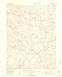
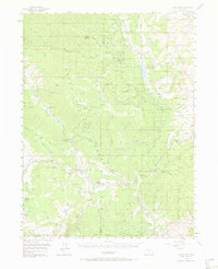
Editions of this 1956 Gore Pass Map
4 editions found
Other maps of this area

1933 · Mt. Powell
USGS Topo · 1:48,000

1940 · Mount Powell
USGS Topo · 1:62,500

1954 · Craig
USGS Topo · 1:250,000

1956 · Lake Agnes
USGS Topo · 1:24,000

1956 · Kremmling
USGS Topo · 1:62,500

1956 · Whiteley Peak
USGS Topo · 1:24,000

1956 · Walton Peak
USGS Topo · 1:24,000

1956 · Gore Pass
USGS Topo · 1:62,500

1956 · Hyannis Peak
USGS Topo · 1:62,500

1956 · Rabbit Ears Peak
USGS Topo · 1:62,500