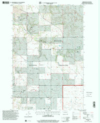
1997 Map of Gorham
USGS Topo · Published 2001About this map
Little Missouri National Grassland dominates this landscape in the late twentieth century, showing a pattern of sprawling ranches across the rugged badlands terrain of Billings County. The map documents the remnants of the settlement at Gorham, alongside vital community landmarks for the surrounding cattle country. Scattered throughout the drainage basins of Whitetail Creek and Betsy Creek, family-named holdings such as Bassarab Ranch, Lowman Ranch, and the Evoniuk Ranch define the local geography. Social and educational history is anchored by Whitetail Sch No 12 and spiritual sites like St Jacobs Cem and St Josephat Cem, providing essential data for genealogists tracing families in this remote portion of North Dakota. Infrastructure such as the Four Eyes Substation and various wells indicate the intersection of traditional ranching with modern utility development.
Find a feature on this map
25 named features on this map. Tap any name to fly to it.
Don’t see what you’re looking for? This feature index may not catch every label — zoom into the map to look around manually.
Map Details
Editions of this 1997 Gorham Map
This is the sole edition of this map. No revisions or reprints were ever made.
Other maps of this area

1953 · Watford City
USGS Topo · 1:250,000

1957 · Watford City
USGS Topo · 1:250,000

1963 · Gorham SW
USGS Topo · 1:24,000

1963 · Gorham NW
USGS Topo · 1:24,000

1963 · Fairfield
USGS Topo · 1:24,000

1963 · Gorham SE
USGS Topo · 1:24,000

1963 · Gorham
USGS Topo · 1:24,000

1963 · Rattlesnake Butte
USGS Topo · 1:24,000

1967 · Watford City
USGS Topo · 1:250,000

1974 · Grassy Butte SW
USGS Topo · 1:24,000