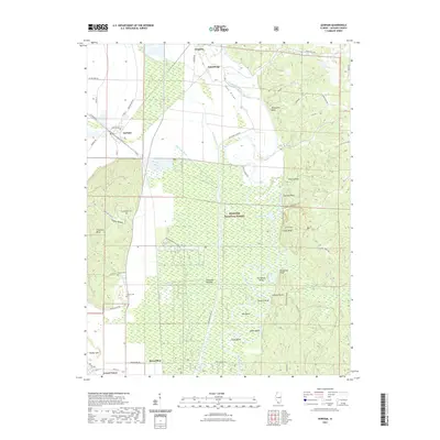
2021 Map of Gorham
USGS Topo · Published 2021About this map
Big Muddy River winds through the heart of the Jackson County floodplain, defining a landscape of intricate bends and low-lying wetlands. This modern survey illustrates the complex hydrology of the region, where the Big Muddy Levee Rd and Hay Glade Ditch manage the waters of the Oakwood Bottoms. The river's serpentine path is marked by numerous named features such as Mill Bend and Cripps Bend, reflecting a long history of navigation and timbering within the Shawnee National Forest.
Find a feature on this map
64 named features on this map. Tap any name to fly to it.
Don’t see what you’re looking for? This feature index may not catch every label — zoom into the map to look around manually.
Map Details
Editions of this 2021 Gorham Map
This is the sole edition of this map. No revisions or reprints were ever made.
Other maps of this area

1910 · Murphysboro
USGS Topo · 1:62,500

1916 · Campbell Hill
USGS Topo · 1:62,500

1918 · Altenburg
USGS Topo · 1:62,500

1918 · Campbell Hill
USGS Topo · 1:62,500

1924 · Alto Pass
USGS Topo · 1:62,500

1925 · Altenburg
USGS Topo · 1:62,500

1938 · Murphysboro
USGS Topo · 1:62,500

1947 · Alto Pass
USGS Topo · 1:62,500

1947 · Gorham
USGS Topo · 1:24,000
1947 · Wolf Lake
USGS Topo · 1:24,000