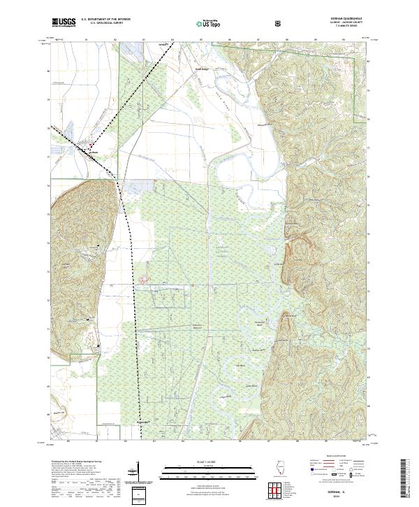
2024 Map of Gorham
USGS Topo · Published 2024About this map
The Big Muddy River dominates the central and eastern portions of this Jackson County landscape, carving a series of dramatic loops including Horseshoe Bend, Rawlins Bend, and Cripps Bend. To the west, the village of Gorham sits at a critical junction of rail and road, bordered by the rising terrain of Fountain Bluff and Walker Hill. The lowlands are defined by the extensive Shawnee National Forest and the Oakwood Bottoms, where a network of drainage features like Hay Glade Ditch and Worthen Bayou manage the wet terrain. Local history is anchored by family-named landmarks such as Goodbread Cem, Henson Cem, and Hudson Cem, alongside established points like Sand Ridge and Howardton. The map reveals a land shaped by the constant movement of water against the stable bluffs of the Illinois river country.
Find a feature on this map
63 named features on this map. Tap any name to fly to it.
Don’t see what you’re looking for? This feature index may not catch every label — zoom into the map to look around manually.
Map Details
Editions of this 2024 Gorham Map
This is the sole edition of this map. No revisions or reprints were ever made.
Other maps of this area

1910 · Murphysboro
USGS Topo · 1:62,500

1916 · Campbell Hill
USGS Topo · 1:62,500

1918 · Altenburg
USGS Topo · 1:62,500

1918 · Campbell Hill
USGS Topo · 1:62,500

1924 · Alto Pass
USGS Topo · 1:62,500

1925 · Altenburg
USGS Topo · 1:62,500

1938 · Murphysboro
USGS Topo · 1:62,500

1947 · Alto Pass
USGS Topo · 1:62,500

1947 · Gorham
USGS Topo · 1:24,000
1947 · Wolf Lake
USGS Topo · 1:24,000