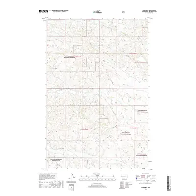
2020 Map of Gorham SW
USGS Topo · Published 2020About this map
Little Missouri National Grassland dominates this portion of the North Dakota badlands, where a complex network of coulees and waterholes defines the remote landscape. The southern edge of the map transitions into the Theodore Roosevelt National Park, featuring the Roundup Camp Trail near the banks of Government Cr. The map reveals a land structured by drainage patterns rather than dense settlement, with named features like Dawsons Waterhole and Wolf Draw serving as vital landmarks for navigation. Transportation is limited to a few arterial routes such as Franks Creek Rd and S Ash Coulee Rd, alongside several primitive tracks designated as Low Maintenance Rd. This layout reflects the area's primary use for conservation and livestock grazing, where water sources like Ash Coulee and Franks Cr dictate the movement of both wildlife and people.
Find a feature on this map
19 named features on this map. Tap any name to fly to it.
Don’t see what you’re looking for? This feature index may not catch every label — zoom into the map to look around manually.
Map Details
Editions of this 2020 Gorham SW Map
This is the sole edition of this map. No revisions or reprints were ever made.
Other maps of this area

1953 · Dickinson
USGS Topo · 1:250,000

1953 · Watford City
USGS Topo · 1:250,000

1957 · Dickinson
USGS Topo · 1:250,000

1957 · Watford City
USGS Topo · 1:250,000

1962 · Fryburg NE
USGS Topo · 1:24,000

1962 · Fryburg NW
USGS Topo · 1:24,000

1963 · Gorham SW
USGS Topo · 1:24,000

1963 · Gorham NW
USGS Topo · 1:24,000

1963 · Gorham SE
USGS Topo · 1:24,000

1963 · Gorham
USGS Topo · 1:24,000