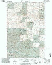
1997 Map of Gorham SW
USGS Topo · Published 2001About this map
Little Missouri National Grassland dominates this corner of Billings County, where the industrial footprint of the Little Missouri Big Stick Oil Field meets the protected landscape of the Theodore Roosevelt National Park. Revised by the Forest Service in 1997 from earlier surveys, the map reveals a rugged western drainage system defined by Franks Creek, Government Creek, and the uniquely named Dousons Waterhole Draw.
Find a feature on this map
13 named features on this map. Tap any name to fly to it.
Don’t see what you’re looking for? This feature index may not catch every label — zoom into the map to look around manually.
Map Details
Editions of this 1997 Gorham SW Map
This is the sole edition of this map. No revisions or reprints were ever made.
Other maps of this area

1953 · Dickinson
USGS Topo · 1:250,000

1953 · Watford City
USGS Topo · 1:250,000

1957 · Dickinson
USGS Topo · 1:250,000

1957 · Watford City
USGS Topo · 1:250,000

1962 · Fryburg NE
USGS Topo · 1:24,000

1962 · Fryburg NW
USGS Topo · 1:24,000

1963 · Gorham SW
USGS Topo · 1:24,000

1963 · Gorham NW
USGS Topo · 1:24,000

1963 · Gorham SE
USGS Topo · 1:24,000

1963 · Gorham
USGS Topo · 1:24,000