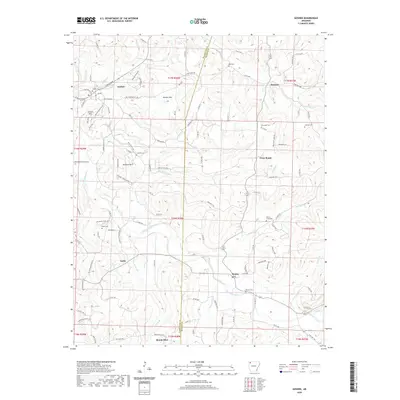
2020 Map of Goshen
USGS Topo · Published 2020About this map
The boundary between Washington and Madison counties divides a landscape defined by the winding course of Richland Creek and its many tributaries. In the northwest, the settlement of Goshen sits near the base of Gilliam Mtn, while further south, the small communities of Tuttle and Mount Olive anchor the rural landscape. The map reveals a dense network of country roads, including the aptly named Fire Tower Rd and Ball Rd, which navigate the terrain between heights like Benson Mtn and Trammel Mt. Genealogists will find a high concentration of family and local burial sites, from the centrally located Culwell Cem to the outlying Boatrigth Cem and Johnson Cem near the Buckeye community. This document captures the modern state of these Ozark foothills, where small settlements like Wesley and Cross Roads still serve as local landmarks amidst a complex drainage system of creeks such as Sinking Cr and Thorney Br.
Find a feature on this map
114 named features on this map. Tap any name to fly to it.
Don’t see what you’re looking for? This feature index may not catch every label — zoom into the map to look around manually.
Map Details
Editions of this 2020 Goshen Map
This is the sole edition of this map. No revisions or reprints were ever made.
Other maps of this area

1898 · Winslow
USGS Topo · 1:125,000

1899 · Fayetteville
USGS Topo · 1:125,000

1900 · Eureka Springs
USGS Topo · 1:125,000

1901 · Winslow
USGS Topo · 1:125,000

1901 · Eureka Springs
USGS Topo · 1:125,000

1901 · Fayetteville
USGS Topo · 1:125,000

1904 · Fayetteville
USGS Topo · 1:125,000

1943 · St. Paul
USGS Topo · 1:62,500

1945 · Harrison
USGS Topo · 1:250,000

1946 · St. Paul
USGS Topo · 1:62,500