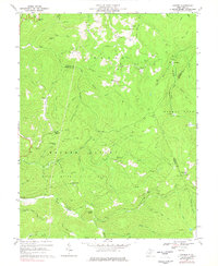
1967 Map of Goshen
USGS Topo · Published 1977About this map
Holly River State Park dominates the central and southern reaches of this landscape, its wilderness areas and campground bordering the Left Fork Holly River. This 1967 survey captures the intersection of three counties—Upshur, Webster, and Randolph—defined by a landscape of high ridges and narrow creek bottoms. The northern section near Goshen and Canaan is marked by early energy development, with numerous Gas Wells and pipelines cutting through the timbered slopes. Along the Right Fork Buckhannon River, the Baltimore and Ohio railroad corridor provides a vital link for local industry, passing near settlements like Arvondale and Craddock. Genealogists will find several family and community landmarks, including Gregory Cem, Rice Cem, and Vance Cem, alongside remote rural houses of worship such as Long Run Ch and Pleasant Hill Ch.
Find a feature on this map
75 named features on this map. Tap any name to fly to it.
Don’t see what you’re looking for? This feature index may not catch every label — zoom into the map to look around manually.
Map Details
Editions of this 1967 Goshen Map
3 editions found
Other maps of this area

1893 · Buckhannon
USGS Topo · 1:125,000

1896 · Buckhannon
USGS Topo · 1:125,000

1897 · Buckhannon
USGS Topo · 1:125,000

1912 · Sago
USGS Topo · 1:48,000

1912 · Crawford
USGS Topo · 1:48,000

1913 · Hacker Valley
USGS Topo · 1:48,000

1913 · Pickens
USGS Topo · 1:48,000

1914 · Sago
USGS Topo · 1:62,500

1914 · Crawford
USGS Topo · 1:62,500

1915 · Hacker Valley
USGS Topo · 1:62,500