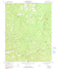
1967 Map of Goshen
USGS Topo · Published 1991About this map
The Little Kanawha River and its numerous forks define this West Virginia landscape where Webster, Upshur, and Randolph counties converge. In the late 1960s, the terrain was a mix of conservation land and active extraction, with a heavy concentration of Gas Wells appearing throughout the northeast, particularly near Canaan and the Baltimore and Ohio rail line. The southern portion of the map is dominated by the northern reaches of Holly River State Park, including landmarks like Potato Knob and the Picnic Area near Hacker Valley.
Find a feature on this map
74 named features on this map. Tap any name to fly to it.
Don’t see what you’re looking for? This feature index may not catch every label — zoom into the map to look around manually.
Map Details
Editions of this 1967 Goshen Map
3 editions found
Other maps of this area

1893 · Buckhannon
USGS Topo · 1:125,000

1896 · Buckhannon
USGS Topo · 1:125,000

1897 · Buckhannon
USGS Topo · 1:125,000

1912 · Sago
USGS Topo · 1:48,000

1912 · Crawford
USGS Topo · 1:48,000

1913 · Hacker Valley
USGS Topo · 1:48,000

1913 · Pickens
USGS Topo · 1:48,000

1914 · Sago
USGS Topo · 1:62,500

1914 · Crawford
USGS Topo · 1:62,500

1915 · Hacker Valley
USGS Topo · 1:62,500