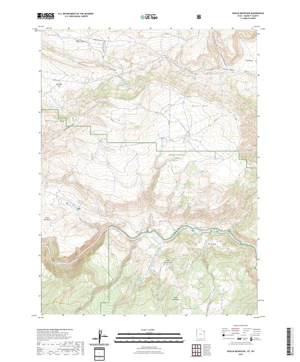
2023 Map of Goslin Mountain
USGS Topo · Published 2023About this map
The Green River carves a deep path through the northern reaches of the Uinta Mountains, defining the complex topography of this Daggett County landscape. Much of the area is managed as part of the Ashley National Forest, where high-elevation features like Goslin Mtn and Dutch John Mtn overlook a series of dramatic drainages including Dutch John Canyon and Red Canyon. This modern survey illustrates the enduring wilderness character of the region, emphasizing the network of springs and draws that sustain the arid high desert. Movement through this difficult terrain is marked by several significant paths, including the Lowline Historic Trl and the Little Hole Trl following the riverbanks. Named landmarks such as The Glades and Antelope Flat point to the historic cattle and wildlife routes that have long traversed the benches above the river.
Find a feature on this map
39 named features on this map. Tap any name to fly to it.
Don’t see what you’re looking for? This feature index may not catch every label — zoom into the map to look around manually.
Map Details
Editions of this 2023 Goslin Mountain Map
This is the sole edition of this map. No revisions or reprints were ever made.
Other maps of this area

1885 · Ashley
USGS Topo · 1:250,000

1952 · Warren Draw
USGS Topo · 1:24,000

1952 · Clay Basin
USGS Topo · 1:24,000

1952 · Dutch John Mtn
USGS Topo · 1:24,000

1952 · Goslin Mtn
USGS Topo · 1:24,000

1954 · Vernal
USGS Topo · 1:250,000

1954 · Rock Springs
USGS Topo · 1:250,000

1957 · Currant Creek Ranch
USGS Topo · 1:62,500

1958 · Vernal
USGS Topo · 1:250,000

1958 · Rock Springs
USGS Topo · 1:250,000