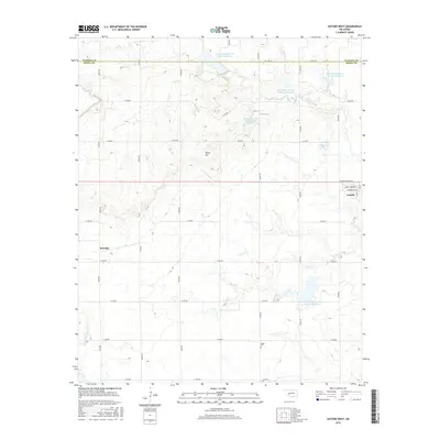
2016 Map of Gotebo West
USGS Topo · Published 2016About this map
Gotebo occupies the eastern edge of this landscape, situated at the intersection of a grid of section roads and the community's primary streets, including Pennsylvania Ave and Commercial Ave. Moving west, the terrain becomes increasingly defined by the complex water management systems of the Rainy Mountain Creek watershed. A series of designated flood control and irrigation basins, such as Rainy Mountain Cr Site 31 Reservoir and Rainy Mountain Creek Site 30 Reservoir, are distributed across the drainage. To the southwest, the smaller settlement of Komalty serves as a secondary focal point. The land's vertical character is highlighted by Tanny Hill, while local history is anchored by the Wyatt Cem in the southern portion of the survey. The map also delineates the boundary between Washita and Kiowa counties, which follows the northern tier of sections.
Find a feature on this map
24 named features on this map. Tap any name to fly to it.
Don’t see what you’re looking for? This feature index may not catch every label — zoom into the map to look around manually.
Map Details
Editions of this 2016 Gotebo West Map
This is the sole edition of this map. No revisions or reprints were ever made.
Other maps of this area

1949 · Cooperton
USGS Topo · 1:62,500

1955 · Lawton
USGS Topo · 1:250,000

1955 · Clinton
USGS Topo · 1:250,000

1956 · Unap Mountain
USGS Topo · 1:24,000

1956 · Rainy Mountain Creek
USGS Topo · 1:24,000

1956 · Cooperton
USGS Topo · 1:62,500

1957 · Clinton
USGS Topo · 1:250,000

1961 · Gotebo
USGS Topo · 1:62,500

1961 · Hobart
USGS Topo · 1:62,500

1963 · Babbs
USGS Topo · 1:24,000