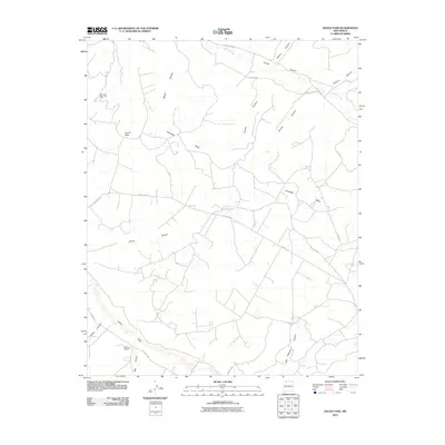
2010 Map of Gould Pass
USGS Topo · Published 2010About this map
Gould Pass sits at the heart of a complex network of dry washes and high mesas in northwestern New Mexico, where the industrial footprint of the San Juan Basin Gas Field meets traditional ranching lands. The landscape is defined by its dramatic drainage patterns, most notably the wide Cañon Largo in the southwest and the winding Carrizo Creek to the north. These natural corridors are flanked by prominent features such as Encinada Mesa and the deep incisions of Martin Canyon and Adolfo Canyon.
Find a feature on this map
25 named features on this map. Tap any name to fly to it.
Don’t see what you’re looking for? This feature index may not catch every label — zoom into the map to look around manually.
Map Details
Editions of this 2010 Gould Pass Map
This is the sole edition of this map. No revisions or reprints were ever made.
Other maps of this area

1889 · Largo
USGS Topo · 1:250,000

1895 · Largo
USGS Topo · 1:250,000

1954 · Aztec
USGS Topo · 1:250,000

1958 · Aztec
USGS Topo · 1:250,000

1959 · Gould Pass
USGS Topo · 1:62,500

1959 · Nageezi
USGS Topo · 1:62,500

1962 · Aztec
USGS Topo · 1:250,000

1963 · Fourmile Canyon
USGS Topo · 1:24,000

1963 · Gonzales Mesa
USGS Topo · 1:24,000
1963 · Santos Peak
USGS Topo · 1:24,000