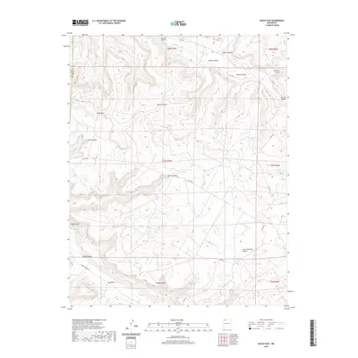
2020 Map of Gould Pass
USGS Topo · Published 2020About this map
Gould Pass anchors this high-desert landscape in the borderlands between San Juan and Rio Arriba counties. The terrain is defined by an intricate network of deep drainages including Martin Canyon and Smith Canyon, which converge toward the broad expanse of Cañon Largo to the southwest. This hydrological pattern reveals the natural corridors used for travel through the San Juan Basin, where routes like Largo Canyon Rd follow the low ground. Higher elevations feature isolated water sources like Cuervo Lake and the seasonally active Carrizo Cr. The map captures the intersection of traditional landform names like Big Rincon with modern rural infrastructure, providing a detailed record of the access roads—such as Co RD 492 and Co RD 500—that service this remote ranching and resource area.
Find a feature on this map
21 named features on this map. Tap any name to fly to it.
Don’t see what you’re looking for? This feature index may not catch every label — zoom into the map to look around manually.
Map Details
Editions of this 2020 Gould Pass Map
This is the sole edition of this map. No revisions or reprints were ever made.
Other maps of this area

1889 · Largo
USGS Topo · 1:250,000

1895 · Largo
USGS Topo · 1:250,000

1954 · Aztec
USGS Topo · 1:250,000

1958 · Aztec
USGS Topo · 1:250,000

1959 · Gould Pass
USGS Topo · 1:62,500

1959 · Nageezi
USGS Topo · 1:62,500

1962 · Aztec
USGS Topo · 1:250,000

1963 · Fourmile Canyon
USGS Topo · 1:24,000

1963 · Gonzales Mesa
USGS Topo · 1:24,000
1963 · Santos Peak
USGS Topo · 1:24,000