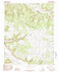
1985 Map of Gould Pass
USGS Topo · Published 1985About this map
Encinada Mesa dominates this high-altitude landscape in Rio Arriba County, where the high desert is carved by an intricate network of drainages and named canyons. The southwestern corner is anchored by the significant Cañon Largo, a major geographical feature that has historically served as a critical travel corridor through this part of the Four Corners region. Just to the north, Gould Pass provides a transition between these deep sandstone cuts and the elevated plateaus.
Find a feature on this map
23 named features on this map. Tap any name to fly to it.
Don’t see what you’re looking for? This feature index may not catch every label — zoom into the map to look around manually.
Map Details
Editions of this 1985 Gould Pass Map
This is the sole edition of this map. No revisions or reprints were ever made.
Other maps of this area

1889 · Largo
USGS Topo · 1:250,000

1895 · Largo
USGS Topo · 1:250,000

1954 · Aztec
USGS Topo · 1:250,000

1958 · Aztec
USGS Topo · 1:250,000

1959 · Gould Pass
USGS Topo · 1:62,500

1959 · Nageezi
USGS Topo · 1:62,500

1962 · Aztec
USGS Topo · 1:250,000

1963 · Fourmile Canyon
USGS Topo · 1:24,000

1963 · Gonzales Mesa
USGS Topo · 1:24,000
1963 · Santos Peak
USGS Topo · 1:24,000