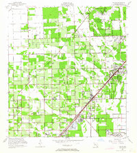
1956 Map of Goulds
USGS Topo · Published 1964About this map
Agricultural groves and citrus packing centers define this 1956 landscape in southern Dade County, where the Florida East Coast and Seaboard Air Line railroads parallel the coast to serve settlements like Goulds and Princeton. The map captures a moment when large-scale military footprints, such as the U S Naval Air Station (Inactive) and Homestead Air Force Base, coexist with established rural institutions like the Redland Sch and the Silver Palm Cem.
Find a feature on this map
47 named features on this map. Tap any name to fly to it.
Don’t see what you’re looking for? This feature index may not catch every label — zoom into the map to look around manually.
Map Details
Editions of this 1956 Goulds Map
4 editions found
Other maps of this area

1949 · South Miami NW
USGS Topo · 1:24,000

1949 · Arsenicker Keys
USGS Topo · 1:24,000

1949 · Goulds
USGS Topo · 1:24,000

1949 · Perrine
USGS Topo · 1:24,000

1950 · Homestead
USGS Topo · 1:24,000

1950 · South Miami
USGS Topo · 1:24,000

1955 · South Miami NW
USGS Topo · 1:24,000

1956 · Goulds
USGS Topo · 1:24,000

1956 · Perrine
USGS Topo · 1:24,000

1956 · South Miami
USGS Topo · 1:24,000
Featured Places
- Princeton, FL
- Goulds, FL
- Naranja, FL
- Leisure Mobile Home Park-Modello Park, FL
- Pine Isle Mobile Home Park, FL