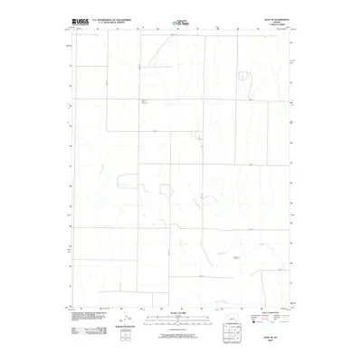
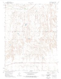
2009 Map of Gove SE
USGS Topo · Published 2009About this map
Smoky Hill River meanders across the southern landscape of this Gove County region, joined by the winding course of Indian Creek. This 2009 survey reflects the high plains' characteristic grid-iron road network, marked by rural routes such as Gove M, Gove E, and Gove 62 that carve the terrain into vast agricultural sections. For those researching local heritage, the map identifies specific points of historical and genealogical significance, notably Morning Star Cemetery in the northwestern quadrant and Alanthus Cemetery situated near the river valley. The landscape is defined by the contrast between these structured county roads and the natural, erratic drainages of the river system, documenting the sparse but persistent settlement pattern of western Kansas in the early 21st century.
Find a feature on this map
15 named features on this map. Tap any name to fly to it.
Don’t see what you’re looking for? This feature index may not catch every label — zoom into the map to look around manually.
Map Details
Editions of this 2009 Gove SE Map
This is the sole edition of this map. No revisions or reprints were ever made.
Other maps of this area

1955 · Scott City
USGS Topo · 1:250,000

1958 · Scott City
USGS Topo · 1:250,000
1972 · Gove NE
USGS Topo · 1:24,000
1972 · Castle Rock NW
USGS Topo · 1:24,000
1972 · Gove
USGS Topo · 1:24,000
1974 · Gove SW
USGS Topo · 1:24,000
1974 · Gove SE
USGS Topo · 1:24,000
1974 · Castle Rock
USGS Topo · 1:24,000
1974 · Shields NW
USGS Topo · 1:24,000
1974 · Pendennis
USGS Topo · 1:24,000