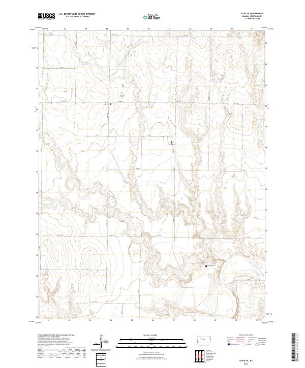
2022 Map of Gove SE
USGS Topo · Published 2022About this map
The Smoky Hill River winds through the southern reaches of this Gove County landscape, creating a distinct topographical break in the High Plains terrain. The area is defined by a grid of rural roads and section lines typical of the Public Land Survey System, with the land divided across townships T13S through T15S. For those tracing local heritage, the map identifies two significant landmarks of early settlement: Morning Star Cem in the north and Alanthus Cem further south near the river valley. The drainage of Indian Cr cuts across the central and southern portions of the quadrangle, feeding into the larger river system. This 2022 edition by the U.S. Geological Survey details a sparsely populated agricultural region where the continuity of land use is reflected in named rural routes like Gove E and Co Rd 470.
Find a feature on this map
22 named features on this map. Tap any name to fly to it.
Don’t see what you’re looking for? This feature index may not catch every label — zoom into the map to look around manually.
Map Details
Editions of this 2022 Gove SE Map
This is the sole edition of this map. No revisions or reprints were ever made.
Other maps of this area

1955 · Scott City
USGS Topo · 1:250,000

1958 · Scott City
USGS Topo · 1:250,000

1972 · Gove NE
USGS Topo · 1:24,000

1972 · Castle Rock NW
USGS Topo · 1:24,000

1972 · Gove
USGS Topo · 1:24,000

1974 · Gove SW
USGS Topo · 1:24,000

1974 · Gove SE
USGS Topo · 1:24,000

1974 · Castle Rock
USGS Topo · 1:24,000

1974 · Shields NW
USGS Topo · 1:24,000

1974 · Pendennis
USGS Topo · 1:24,000