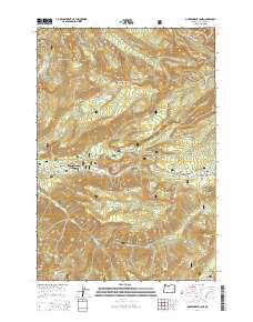
2014 Map of Government Camp
USGS Topo · Published 2014About this map
Government Camp and Mount Hood Village serve as the primary gateways to the high-elevation terrain of the Mount Hood National Forest on this 2014 survey. The Mount Hood Hwy provides the central artery through this landscape, flanked by significant geographical landmarks such as Laurel Hill and the steep walls of Zigzag Canyon. The map illustrates a dense network of alpine water features and hiking corridors, most notably a segment of the Pacific Crest National Scenic Trail.
Find a feature on this map
59 named features on this map. Tap any name to fly to it.
Don’t see what you’re looking for? This feature index may not catch every label — zoom into the map to look around manually.
Map Details
Editions of this 2014 Government Camp Map
This is the sole edition of this map. No revisions or reprints were ever made.
Other maps of this area

1924 · Mount Hood
USGS Topo · 1:125,000

1927 · Mount Hood
USGS Topo · 1:125,000

1953 · The Dalles
USGS Topo · 1:250,000

1956 · The Dalles
USGS Topo · 1:250,000

1956 · High Rock
USGS Topo · 1:62,500

1956 · Mt. Wilson
USGS Topo · 1:62,500

1957 · The Dalles
USGS Topo · 1:250,000
1962 · Hickman Butte
USGS Topo · 1:24,000

1962 · Cathedral Ridge
USGS Topo · 1:24,000
1962 · Government Camp
USGS Topo · 1:24,000