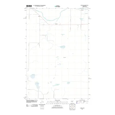
2010 Map of Gowan
USGS Topo · Published 2010About this map
The Saint Louis River snakes across the northern reaches of this Saint Louis County landscape, defining the character of the small settlements at Gowan and Paupores. This region is defined by its complex hydrology, where the Ahmik River and Hasty Brook drain into a series of interior basins. The terrain is marked by numerous water bodies of varying size, from the prominent Kingburg Lake and Murphy Lake to the more secluded Bog Lake and Thirtysix Lake.
Find a feature on this map
26 named features on this map. Tap any name to fly to it.
Don’t see what you’re looking for? This feature index may not catch every label — zoom into the map to look around manually.
Map Details
Editions of this 2010 Gowan Map
This is the sole edition of this map. No revisions or reprints were ever made.
Other maps of this area

1953 · Brookston NW
USGS Topo · 1:24,000

1953 · Duluth
USGS Topo · 1:250,000

1954 · Sawyer
USGS Topo · 1:24,000

1954 · Martin Lake
USGS Topo · 1:24,000

1956 · Barnum
USGS Topo · 1:62,500

1958 · Duluth
USGS Topo · 1:250,000

1961 · Cromwell
USGS Topo · 1:62,500

1963 · Gowan
USGS Topo · 1:24,000

1963 · Prairie Lake
USGS Topo · 1:24,000
1963 · Mc Carty River
USGS Topo · 1:24,000