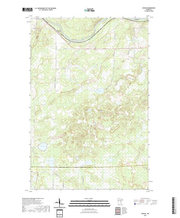
2022 Map of Gowan
USGS Topo · Published 2022About this map
The Saint Louis River and Akmik River define the northern drainage of this landscape along the border of St. Louis and Carlton counties. The small settlement of Gowan serves as a primary point of reference in the northwest, while Paupores sits near the northeastern corner. The terrain is a complex mosaic of wetlands and small water bodies, including Headquarters Lake, Thirtysix Lake, and Heikkila Lake, illustrating the post-glacial topography of northern Minnesota.
Find a feature on this map
39 named features on this map. Tap any name to fly to it.
Don’t see what you’re looking for? This feature index may not catch every label — zoom into the map to look around manually.
Map Details
Editions of this 2022 Gowan Map
This is the sole edition of this map. No revisions or reprints were ever made.
Other maps of this area

1953 · Brookston NW
USGS Topo · 1:24,000

1953 · Duluth
USGS Topo · 1:250,000

1954 · Sawyer
USGS Topo · 1:24,000

1954 · Martin Lake
USGS Topo · 1:24,000

1956 · Barnum
USGS Topo · 1:62,500

1958 · Duluth
USGS Topo · 1:250,000

1961 · Cromwell
USGS Topo · 1:62,500

1963 · Gowan
USGS Topo · 1:24,000

1963 · Prairie Lake
USGS Topo · 1:24,000
1963 · Mc Carty River
USGS Topo · 1:24,000