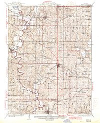
1925 Map of Gower
USGS Topo · Published 1944About this map
The Platte River meanders through Northwest Missouri, anchoring a landscape defined by its early 20th-century rail infrastructure and rural social hubs. In this era, the town of Gower sits at the junction of the Atchison Topeka and Santa Fe and the Chicago Great Western railroads, serving as a primary shipping point. Farther south, Edgerton and Grayson mark the passage of the Chicago Rock Island and Pacific line.
Find a feature on this map
89 named features on this map. Tap any name to fly to it.
Don’t see what you’re looking for? This feature index may not catch every label — zoom into the map to look around manually.
Map Details
Editions of this 1925 Gower Map
3 editions found
Other maps of this area

1890 · Kansas City
USGS Topo · 1:125,000

1894 · Kansas City
USGS Topo · 1:125,000

1894 · Independence
USGS Topo · 1:125,000

1910 · Leavenworth
USGS Topo · 1:62,500

1914 · Smithville
USGS Topo · 1:62,500

1923 · Clarksdale
USGS Topo · 1:62,500

1923 · Maysville
USGS Topo · 1:62,500

1924 · St. Joseph
USGS Topo · 1:62,500

1925 · Gower
USGS Topo · 1:62,500

1925 · Clarksdale
USGS Topo · 1:62,500