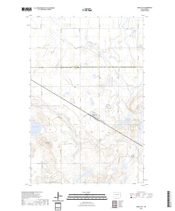
2024 Map of Grace City
USGS Topo · Published 2024About this map
Grace City sits at the heart of this East Central North Dakota landscape, situated along the James River and defined by its grid of local streets like N Railroad Ave and S Railroad Ave. The terrain here is characterized by the prairie pothole region's distinctive hydrology, with numerous wetlands such as Rusten Slough and Blue-Cloud Lake scattered across the township lines of Foster Co and Eddy Co. This area remains a vital corridor for conservation, highlighted by the extensive Foster County Waterfowl Production Area that buffers the river's eastern banks.
Find a feature on this map
73 named features on this map. Tap any name to fly to it.
Don’t see what you’re looking for? This feature index may not catch every label — zoom into the map to look around manually.
Map Details
Editions of this 2024 Grace City Map
This is the sole edition of this map. No revisions or reprints were ever made.
Other maps of this area

1900 · Pingree
USGS Topo · 1:125,000

1944 · Brantford
USGS Topo · 1:62,500

1946 · Brantford
USGS Topo · 1:62,500

1949 · Grace City
USGS Topo · 1:24,000

1950 · Brantford NW
USGS Topo · 1:24,000

1950 · Grace City
USGS Topo · 1:24,000

1950 · Brantford
USGS Topo · 1:24,000

1950 · Brantford NE
USGS Topo · 1:24,000

1951 · Bordulac NE
USGS Topo · 1:24,000

1951 · Kensal NW
USGS Topo · 1:24,000