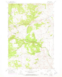
1963 Map of Grace
USGS Topo · Published 1978About this map
Deerlodge National Forest dominates this high-country landscape, where the headwaters of Little Pipestone Creek and Fish Creek carve through the Continental Divide area. This mid-century survey captures the remote operations of the Chicago Milwaukee St Paul and Pacific railroad as it winds through mountain passes, serving small stations and sidings such as Grace and Cedric. The presence of Nineteen Mile and scattered infrastructure like Rader Creek Road reflects the area's history of transit and timber management.
Find a feature on this map
25 named features on this map. Tap any name to fly to it.
Don’t see what you’re looking for? This feature index may not catch every label — zoom into the map to look around manually.
Map Details
Editions of this 1963 Grace Map
3 editions found
Other maps of this area

1893 · Dillon
USGS Topo · 1:250,000

1955 · Dillon
USGS Topo · 1:250,000

1957 · Dillon
USGS Topo · 1:250,000

1958 · Dillon
USGS Topo · 1:250,000

1960 · Twin Bridges
USGS Topo · 1:62,500

1960 · Waterloo
USGS Topo · 1:62,500

1962 · Dillon
USGS Topo · 1:250,000
1963 · Dry Mountain
USGS Topo · 1:24,000

1963 · Pipestone Pass
USGS Topo · 1:24,000

1963 · Vendome
USGS Topo · 1:24,000