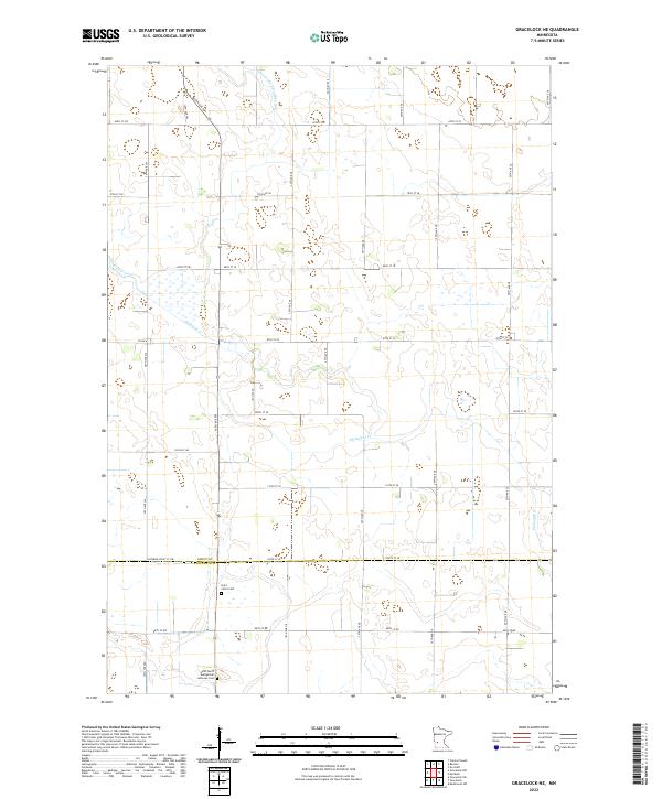
2022 Map of Gracelock NE
USGS Topo · Published 2022About this map
Shakopee Creek winds through this rural landscape along the border of Swift and Chippewa counties. The area is defined by a grid of agricultural section lines and drainage systems, most notably Judicial Ditch Number Five, which reflects the long-term engineering of the prairie to support local farming. This 2022 survey documents a quiet, traditional geography where small community landmarks remain central to the local identity.
Find a feature on this map
44 named features on this map. Tap any name to fly to it.
Don’t see what you’re looking for? This feature index may not catch every label — zoom into the map to look around manually.
Map Details
Editions of this 2022 Gracelock NE Map
This is the sole edition of this map. No revisions or reprints were ever made.
Other maps of this area

1953 · Saint Cloud
USGS Topo · 1:250,000

1957 · Saint Cloud
USGS Topo · 1:250,000

1958 · Saint Cloud
USGS Topo · 1:250,000

1958 · Murdock
USGS Topo · 1:24,000

1958 · Gracelock NE
USGS Topo · 1:24,000

1958 · Kerkhoven SW
USGS Topo · 1:24,000

1958 · Gracelock NW
USGS Topo · 1:24,000

1958 · Gracelock
USGS Topo · 1:24,000

1958 · Gracelock SW
USGS Topo · 1:24,000

1968 · De Graff
USGS Topo · 1:24,000