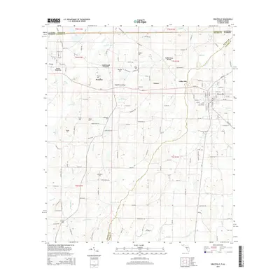
2015 Map of Graceville
USGS Topo · Published 2015About this map
Graceville and Noma anchor this survey of the Florida-Alabama borderlands during a period of modern agricultural and educational development. The town of Graceville serves as a local hub, housing The Baptist Coll of Florida and sitting at the intersection of critical regional routes like SR-2 and Highway 173. The landscape is characterized by a series of named elevations including Riley Hill, McIntosh Hill, and Worley Hill, which overlook the winding course of Holmes Cr. Historically significant sites like Selma Cem and Damascus Cem are preserved alongside former industrial and transit points such as Collins Mill, Noma Junction, and Underwood Crossing. The L&N RR line cuts through the northwestern corner, illustrating the enduring importance of rail connectivity in Jackson and Holmes Counties. Small rural communities like Eleanor and Cobb Cross Roads remain connected by an extensive network of named local roads, including Selma Church Rd and Bony Bridge Rd.
Find a feature on this map
145 named features on this map. Tap any name to fly to it.
Don’t see what you’re looking for? This feature index may not catch every label — zoom into the map to look around manually.
Map Details
Editions of this 2015 Graceville Map
This is the sole edition of this map. No revisions or reprints were ever made.
Other maps of this area

1942 · Enterprise
USGS Topo · 1:125,000

1950 · Chipley
USGS Topo · 1:24,000

1950 · Esto
USGS Topo · 1:24,000

1951 · Graceville
USGS Topo · 1:24,000

1951 · Esto
USGS Topo · 1:24,000

1951 · Chipley
USGS Topo · 1:24,000

1951 · Bonifay
USGS Topo · 1:24,000

1952 · Campbellton
USGS Topo · 1:24,000

1952 · Cottondale West
USGS Topo · 1:24,000

1953 · Dothan
USGS Topo · 1:250,000