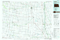
1985 Map of Grafton
USGS Topo · Published 1985About this map
The Red River Valley's agricultural heartland unfolds along the border of North Dakota and Minnesota, anchored by the seat of Grafton. This mid-1980s landscape is defined by the meandering Red River of the North and its intricate network of drainage systems, including Judicial Ditch No 9 and County Ditch No 13. The region's dependence on rail transport is evident in the path of the Burlington Northern and Soo Line railroads, which connect smaller grain-handling points like Minto, Voss, and Ardoch.
Find a feature on this map
75 named features on this map. Tap any name to fly to it.
Don’t see what you’re looking for? This feature index may not catch every label — zoom into the map to look around manually.
Map Details
Editions of this 1985 Grafton Map
2 editions found
Other maps of this area

1918 · Acton
USGS Topo · 1:62,500

1918 · Argyle
USGS Topo · 1:62,500

1918 · Warren
USGS Topo · 1:62,500

1926 · Ardoch
USGS Topo · 1:62,500

1934 · Emerado
USGS Topo · 1:48,000

1934 · Grand Forks
USGS Topo · 1:24,000

1934 · Grand Forks
USGS Topo · 1:62,500

1936 · Emerado
USGS Topo · 1:62,500

1936 · Larimore
USGS Topo · 1:62,500

1938 · Grand Forks
USGS Topo · 1:62,500