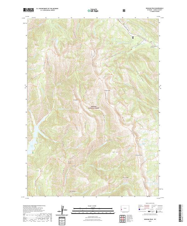
2021 Map of Graham Peak
USGS Topo · Published 2021About this map
The Elizabeth Paul Grave sits near the northeastern corner of this high-elevation terrain, a poignant marker along the historic westward migration route. This portion of the Bridger National Forest is defined by a series of prominent ridges, most notably Commissary Ridge, which runs north-to-south and serves as a spine for the Commissary Ridge Trl. The landscape is characterized by its high summits, including Graham Peak, Mt Isabel, and Fontenelle Mtn, which overlook a network of alpine water systems such as Lake Alice and the Fontenelle Lakes.
Find a feature on this map
62 named features on this map. Tap any name to fly to it.
Don’t see what you’re looking for? This feature index may not catch every label — zoom into the map to look around manually.
Map Details
Editions of this 2021 Graham Peak Map
This is the sole edition of this map. No revisions or reprints were ever made.
Other maps of this area

1921 · Afton
USGS Topo · 1:125,000

1936 · Cokeville
USGS Topo · 1:96,000

1942 · Cokeville
USGS Topo · 1:125,000

1955 · Preston
USGS Topo · 1:250,000

1958 · Preston
USGS Topo · 1:250,000

1962 · Preston
USGS Topo · 1:250,000

1967 · Devils Hole Creek
USGS Topo · 1:24,000

1967 · Graham Peak
USGS Topo · 1:24,000

1967 · Big Park
USGS Topo · 1:24,000

1967 · Porcupine Creek
USGS Topo · 1:24,000