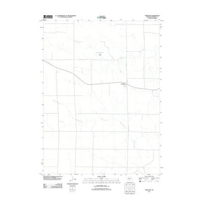
2011 Map of Grainton
USGS Topo · Published 2011About this map
Grainton stands as a focal point in this high-plains landscape of Perkins County, situated at a cross-section of early transportation routes and modern farm-to-market roads. The settlement pattern is defined by the rigid township and range grid, where arterial routes like Grover Ave and Garver Ave provide structure to the agricultural expanse. Water management is central to the area's utility, evidenced by the infrastructure at Harms Reservoir and Harms Dam. The drainage of Blackwood Creek meanders across the southern and central sections of the quadrangle, contrasting with the straight-line precision of the roadway network. This 2011 survey also documents the alignment of Old Hwy 77, tracing the historical movement patterns through the Nebraska panhandle region.
Find a feature on this map
7 named features on this map. Tap any name to fly to it.
Don’t see what you’re looking for? This feature index may not catch every label — zoom into the map to look around manually.
Map Details
Editions of this 2011 Grainton Map
This is the sole edition of this map. No revisions or reprints were ever made.
Other maps of this area

1954 · McCook
USGS Topo · 1:250,000

1957 · McCook
USGS Topo · 1:250,000

1958 · McCook
USGS Topo · 1:250,000
1973 · Grainton
USGS Topo · 1:24,000

1973 · Dittons Creek NE
USGS Topo · 1:24,000
1973 · Elsie NW
USGS Topo · 1:24,000

1973 · Dittons Creek NW
USGS Topo · 1:24,000
1973 · Elsie
USGS Topo · 1:24,000
1973 · Wallace NW
USGS Topo · 1:24,000
1973 · Wallace
USGS Topo · 1:24,000