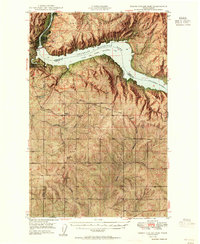
1950 Map of Grand Coulee Dam
USGS Topo · Published 1955About this map
The Grand Coulee Dam dominates the landscape of north-central Washington on this 1950s survey, showing the transformative impact of the Columbia Basin Project. The massive impoundment created the Franklin D Roosevelt Lake, which stretches eastward through the Colville Indian Reservation. High-voltage Bonneville Power Transmission Lines radiate from the dam site, cutting across the arid plateaus of Lincoln Co.
Find a feature on this map
44 named features on this map. Tap any name to fly to it.
Don’t see what you’re looking for? This feature index may not catch every label — zoom into the map to look around manually.
Map Details
Editions of this 1950 Grand Coulee Dam Map
2 editions found
Other maps of this area

1948 · Grand Coulee Dam
USGS Topo · 1:62,500

1948 · Wilbur
USGS Topo · 1:62,500

1950 · Wilbur
USGS Topo · 1:62,500

1950 · Grand Coulee Dam
USGS Topo · 1:62,500

1950 · Nespelem
USGS Topo · 1:62,500

1950 · Alameda Flat
USGS Topo · 1:62,500

1952 · Alameda Flat
USGS Topo · 1:62,500

1952 · Keller
USGS Topo · 1:62,500

1953 · Ritzville
USGS Topo · 1:250,000

1954 · Okanogan
USGS Topo · 1:250,000