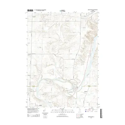
2015 Map of Grand Detour
USGS Topo · Published 2015About this map
Rock River carves a dramatic oxbow through this portion of the Ogle and Lee County border, creating the distinctive geography that gives Grand Detour its name. The terrain is marked by the drainage systems of Pine Creek, Franklin Cr, and Chamberlain Cr, which have shaped the agricultural layout of the region. This 2015 survey reveals a landscape deeply connected to its pioneer roots, preserved through numerous small burial grounds such as Oak Ridge Cem, Brethren Cem, and Pine Creek Christian Cem. The settlement pattern follows the river's path and the section lines, with the historic community of Kingdom and the northern outskirts of Dixon anchored by a network of rural roads like W Pines Rd and S Lowell Park Rd. The map offers a clear view of how modern property divisions and transportation corridors respect the natural contours of the river valley.
Find a feature on this map
81 named features on this map. Tap any name to fly to it.
Don’t see what you’re looking for? This feature index may not catch every label — zoom into the map to look around manually.
Map Details
Editions of this 2015 Grand Detour Map
This is the sole edition of this map. No revisions or reprints were ever made.
Other maps of this area

1918 · Dixon
USGS Topo · 1:62,500

1922 · Oregon
USGS Topo · 1:62,500

1924 · Oregon
USGS Topo · 1:62,500

1930 · Woodsung
USGS Topo · 1:48,000

1942 · Forreston
USGS Topo · 1:62,500

1945 · Forreston
USGS Topo · 1:62,500

1946 · Sterling
USGS Topo · 1:62,500

1948 · Sterling
USGS Topo · 1:62,500

1950 · Dixon
USGS Topo · 1:62,500

1954 · Rockford
USGS Topo · 1:250,000