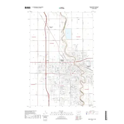
2017 Map of Grand Forks
USGS Topo · Published 2017About this map
Grand Forks and its neighbor across the water, East Grand Forks, dominate this riverfront landscape at the confluence of the Red River of the North and the Red Lake River. The urban layout reflects the central role of the Univ of North Dakota, while the Bnsf Railway and various industrial sidings at Calspur underscore the region's enduring connection to rail commerce. The map documents a blend of residential growth and academic infrastructure, with landmarks like the Fox Bridge and multiple cemeteries—including North Cem and Calvary Cem—providing touchstones for local researchers. To the north, the terrain transitions toward North Grand Forks, while the southeastern corner is defined by the Altamont Moraine, illustrating the glacial history that shaped the Red River Valley’s famously flat topography.
Find a feature on this map
188 named features on this map. Tap any name to fly to it.
Don’t see what you’re looking for? This feature index may not catch every label — zoom into the map to look around manually.
Map Details
Editions of this 2017 Grand Forks Map
This is the sole edition of this map. No revisions or reprints were ever made.
Other maps of this area

1918 · Warren
USGS Topo · 1:62,500

1934 · Grand Forks
USGS Topo · 1:24,000

1934 · Grand Forks
USGS Topo · 1:62,500

1938 · Grand Forks
USGS Topo · 1:62,500

1952 · Grand Forks
USGS Topo · 1:250,000

1952 · Thief River Falls
USGS Topo · 1:250,000

1955 · Warren
USGS Topo · 1:62,500

1956 · Thief River Falls
USGS Topo · 1:250,000

1956 · Grand Forks
USGS Topo · 1:250,000

1957 · Thief River Falls
USGS Topo · 1:250,000