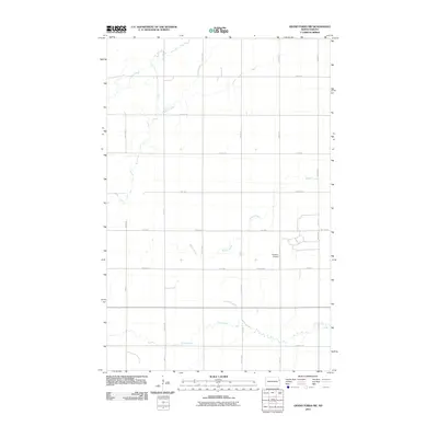
2011 Map of Grand Forks SW
USGS Topo · Published 2011About this map
English Coulee meanders through this agricultural landscape in Grand Forks County, defining a drainage pattern that has shaped the local land use. This 2011 survey by the U.S. Geological Survey captures the rural infrastructure southwest of the city, where a systematic grid of roads like 18th St NE and 11th Ave divides the prairie into distinct parcels. The presence of Knutson Airport serves as a small aviation landmark amidst the fields, while Wilson Creek and Elm Coulee provide further geographic definition to the terrain. The map reflects a modern period of rural stability, where the intersection of traditional section lines and natural waterways continues to dictate the placement of farmsteads and transport routes in the Red River Valley region.
Find a feature on this map
28 named features on this map. Tap any name to fly to it.
Don’t see what you’re looking for? This feature index may not catch every label — zoom into the map to look around manually.
Map Details
Editions of this 2011 Grand Forks SW Map
This is the sole edition of this map. No revisions or reprints were ever made.
Other maps of this area

1934 · Emerado
USGS Topo · 1:48,000

1934 · Grand Forks
USGS Topo · 1:24,000

1934 · Grand Forks
USGS Topo · 1:62,500

1936 · Emerado
USGS Topo · 1:62,500

1938 · Grand Forks
USGS Topo · 1:62,500

1952 · Grand Forks
USGS Topo · 1:250,000

1956 · Grand Forks
USGS Topo · 1:250,000
1963 · Kelly
USGS Topo · 1:24,000

1963 · Emerado SE
USGS Topo · 1:24,000
1963 · Emerado
USGS Topo · 1:24,000