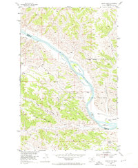
1954 Map of Grand Island
USGS Topo · Published 1974About this map
The Missouri River cuts a wide path through the Missouri River Basin in this mid-century survey, defining the boundary between Phillips and Fergus counties. The landscape is dominated by the expansive Fort Peck Game Range, where high ground like Barnes Ridge, Two Calf Ridge, and Knox Ridge overlooks the river valley. Along the water, distinct features such as Grand Island, Upper Two Calf I, and Lower Two Calf Island break the river's flow, while Kendall Bottoms provides a rare stretch of level terrain below the bluffs. The map's topography, developed from 1952 aerial photography, captures the intricate network of drainages including Antelope Creek and Reed Coulee, which carve through the breaks toward the Missouri. Human activity is sparse, marked only by remote triangulation points like VABM Crystal and a solitary Landing Strip near the southern edge.
Find a feature on this map
18 named features on this map. Tap any name to fly to it.
Don’t see what you’re looking for? This feature index may not catch every label — zoom into the map to look around manually.
Map Details
Editions of this 1954 Grand Island Map
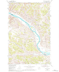
3 editions found
Other maps of this area

1943 · Landusky
USGS Topo · 1:125,000

1954 · Cow Island
USGS Topo · 1:24,000

1954 · Hessler Ridge
USGS Topo · 1:24,000

1954 · Baker Monument
USGS Topo · 1:24,000

1954 · Bell Ridge West
USGS Topo · 1:24,000

1954 · Grand Island
USGS Topo · 1:24,000

1954 · Lewistown
USGS Topo · 1:250,000

1959 · Lewistown
USGS Topo · 1:250,000
1971 · D Y Junction
USGS Topo · 1:24,000
1971 · Shetland Divide
USGS Topo · 1:24,000