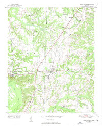
1951 Map of Grand Junction
USGS Topo · Published 1951About this map
The rail junction at Grand Junction serves as the focal point of this 1951 survey, where the Southern line crosses the Illinois Central tracks. This logistical hub in Fayette and Hardeman Counties is surrounded by a rural landscape defined by community institutions and large estates like the Ames Plantation. The map reveals a dense network of country schools and churches that served the agrarian population, including Jones Chapel Sch and Hunts Chapel Sch.
Find a feature on this map
28 named features on this map. Tap any name to fly to it.
Don’t see what you’re looking for? This feature index may not catch every label — zoom into the map to look around manually.
Map Details
Editions of this 1951 Grand Junction Map
2 editions found
Other maps of this area

1949 · Moscow
USGS Topo · 1:62,500

1950 · Ashland
USGS Topo · 1:62,500

1950 · Middleburg
USGS Topo · 1:24,000

1950 · Grand Junction
USGS Topo · 1:24,000

1951 · Middleburg
USGS Topo · 1:24,000

1951 · Hickory Valley
USGS Topo · 1:24,000

1951 · Grand Junction
USGS Topo · 1:24,000

1952 · Saulsbury
USGS Topo · 1:24,000

1953 · Holly Springs
USGS Topo · 1:62,500

1956 · Blytheville
USGS Topo · 1:250,000