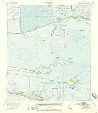
1955 Map of Grand Lake West
USGS Topo · Published 1956About this map
Lacassine National Wildlife Refuge dominates the northern reaches of this coastal Louisiana landscape, where the Intracoastal Waterway cuts a straight path through the marshlands of Cameron Parish. The region is defined by its series of cheniers—low, sandy ridges that support settlement above the surrounding wetlands. Along these elevated landforms, communities like Grand Cheniere and Little Cheniere took root, supported by a network of drainage canals and small cemeteries such as Boudoin Cem and Cheniere Perdue Cem.
Find a feature on this map
63 named features on this map. Tap any name to fly to it.
Don’t see what you’re looking for? This feature index may not catch every label — zoom into the map to look around manually.
Map Details
Editions of this 1955 Grand Lake West Map
3 editions found
Other maps of this area

1932 · Lake Charles SE
USGS Topo · 1:31,680

1932 · Constance Bayou NW
USGS Topo · 1:31,680

1934 · Catfish Lake
USGS Topo · 1:24,000

1934 · Lake Misere
USGS Topo · 1:24,000

1934 · Boudreaux Lake
USGS Topo · 1:24,000

1934 · Latania Lake
USGS Topo · 1:24,000

1935 · Lake Misere
USGS Topo · 1:31,680

1935 · Catfish Lake
USGS Topo · 1:31,680

1935 · Latania Lake
USGS Topo · 1:31,680

1935 · Boudreaux Lake
USGS Topo · 1:31,680