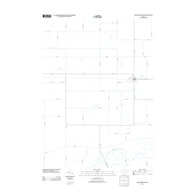
2013 Map of Grand Mound
USGS Topo · Published 2013About this map
Grand Mound serves as the primary hub of activity on this prairie landscape, where the town's grid of streets like Fulton St and Smith St stands in contrast to the surrounding section lines. The geography is defined by a series of waterways that drainage the agricultural fields, most notably the winding Wapsipinicon River which cuts across the southern portion of the quadrangle with its complex series of oxbows and marshy bends. Tributaries such as Calamus Cr and Barber Cr meander through the countryside, illustrating the natural drainage patterns of this Iowa county. Rural life is anchored by a strictly ordered road network, though local landmarks like Kageman's Rd and Sunnyside St offer specific points of interest for those tracing the development of the township near the turn of the 21st century.
Find a feature on this map
43 named features on this map. Tap any name to fly to it.
Don’t see what you’re looking for? This feature index may not catch every label — zoom into the map to look around manually.
Map Details
Editions of this 2013 Grand Mound Map
This is the sole edition of this map. No revisions or reprints were ever made.
Other maps of this area

1890 · Durant
USGS Topo · 1:62,500

1891 · DeWitt
USGS Topo · 1:62,500

1891 · Davenport
USGS Topo · 1:62,500

1892 · Wheatland
USGS Topo · 1:62,500

1894 · Wheatland
USGS Topo · 1:62,500

1894 · Durant
USGS Topo · 1:62,500

1894 · Davenport
USGS Topo · 1:62,500

1901 · Rock Island
USGS Topo · 1:125,000

1910 · Rock Island
USGS Topo · 1:125,000
1953 · De Witt
USGS Topo · 1:24,000