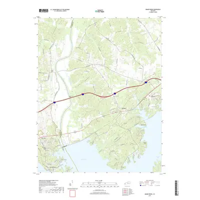
2019 Map of Grand Rivers
USGS Topo · Published 2019About this map
Lake Barkley and Kentucky Lake dominate this portion of western Kentucky, where the narrow land bridge between the two great impoundments defines the local geography. The settlement of Grand Rivers sits at the southern end of the sheet, while the larger town of Kuttawa occupies the eastern shoreline. The landscape is marked by a legacy of transport and river crossings, evidenced by labels like Iuka Ferry Rd and the Ralph Smith Bridge spanning the Cumberland River. Inland, the terrain is dotted with family-named landmarks and local burial grounds such as Chestnut Oak Cem and Peek Cem. The presence of the Tennessee Valley Railroad Museum near Grand Rivers highlights the region's rail heritage, while the State Penal Farm occupies a significant tract of land to the north, illustrating the diverse land use in this river-bound corridor.
Find a feature on this map
111 named features on this map. Tap any name to fly to it.
Don’t see what you’re looking for? This feature index may not catch every label — zoom into the map to look around manually.
Map Details
Editions of this 2019 Grand Rivers Map
This is the sole edition of this map. No revisions or reprints were ever made.
Other maps of this area

1928 · Eddyville
USGS Topo · 1:48,000

1929 · Smithland
USGS Topo · 1:62,500

1931 · Eddyville
USGS Topo · 1:62,500

1936 · Eddyville
USGS Topo · 1:48,000

1936 · Mont
USGS Topo · 1:24,000

1936 · Grand Rivers
USGS Topo · 1:24,000

1936 · Smithland
USGS Topo · 1:48,000

1936 · Benton
USGS Topo · 1:48,000

1936 · Birmingham
USGS Topo · 1:24,000

1936 · Golden Pond
USGS Topo · 1:48,000