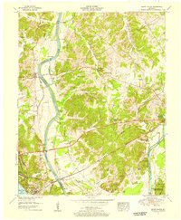
1955 Map of Grand Rivers
USGS Topo · Published 1956About this map
Cumberland River navigation and the growing impact of reservoir management define this mid-century landscape between Grand Rivers and Kuttawa. The map captures a critical transition as the newly formed Kentucky Lake occupies the southwestern corner, contrasted with the winding river valley to the north. A dense network of landings like Knoth Landing, Doom Landing, and Jarrett Landing speaks to the region's enduring reliance on the river, while the Illinois Central Railroad cuts across the terrain as a major transit artery. Local institutions are prominent, including the Kentucky State Penitentiary Farm and several community landmarks such as Suwanee Furnace Church and McPhail School. The presence of the Kentucky Woodlands Wildlife Refuge indicates the dedication of land for conservation as the traditional river-and-rail economy evolved alongside modern hydroelectric and recreational infrastructure.
Find a feature on this map
56 named features on this map. Tap any name to fly to it.
Don’t see what you’re looking for? This feature index may not catch every label — zoom into the map to look around manually.
Map Details
Editions of this 1955 Grand Rivers Map
This is the sole edition of this map. No revisions or reprints were ever made.
Other maps of this area

1928 · Eddyville
USGS Topo · 1:48,000

1929 · Smithland
USGS Topo · 1:62,500

1931 · Eddyville
USGS Topo · 1:62,500

1936 · Eddyville
USGS Topo · 1:48,000

1936 · Mont
USGS Topo · 1:24,000

1936 · Grand Rivers
USGS Topo · 1:24,000

1936 · Smithland
USGS Topo · 1:48,000

1936 · Benton
USGS Topo · 1:48,000

1936 · Birmingham
USGS Topo · 1:24,000

1936 · Golden Pond
USGS Topo · 1:48,000