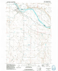
1992 Map of Grand View
USGS Topo · Published 1992About this map
Snake River bends and island-braids define this high-desert corridor where Elmore and Owyhee counties meet. The settlement of Grand View serves as the focal point for this agricultural and geothermal landscape, supported by the Grand View Canal and Grand View Mutual Canal. Evidence of the region's unique geology is present in several labeled Flowing Geothermal Wells scattered across Chattin Flat and near Shoofly Creek. Irrigation infrastructure, including a prominent siphon and aqueduct, enables ranching at sites like Dixie Ranch and Whitson Ranch. Significant conservation land is visible, with the Birds of Prey Area bordering the river bluffs alongside the Trueblood Wildlife Area and C J Strike Wildlife Management Area. Local community life is marked by the rodeo grounds, a trailer park, and the village cemetery.
Find a feature on this map
32 named features on this map. Tap any name to fly to it.
Don’t see what you’re looking for? This feature index may not catch every label — zoom into the map to look around manually.
Map Details
Editions of this 1992 Grand View Map
This is the sole edition of this map. No revisions or reprints were ever made.
Other maps of this area

1892 · Mountain Home
USGS Topo · 1:125,000

1892 · Bisuka
USGS Topo · 1:125,000

1893 · Mountain Home
USGS Topo · 1:125,000

1894 · Bisuka
USGS Topo · 1:125,000

1946 · Mouth of Bruneau
USGS Topo · 1:24,000

1947 · Little Valley
USGS Topo · 1:24,000

1947 · Grand View
USGS Topo · 1:62,500

1947 · Bruneau
USGS Topo · 1:62,500

1947 · Grand View
USGS Topo · 1:24,000

1947 · Jackass Butte
USGS Topo · 1:24,000