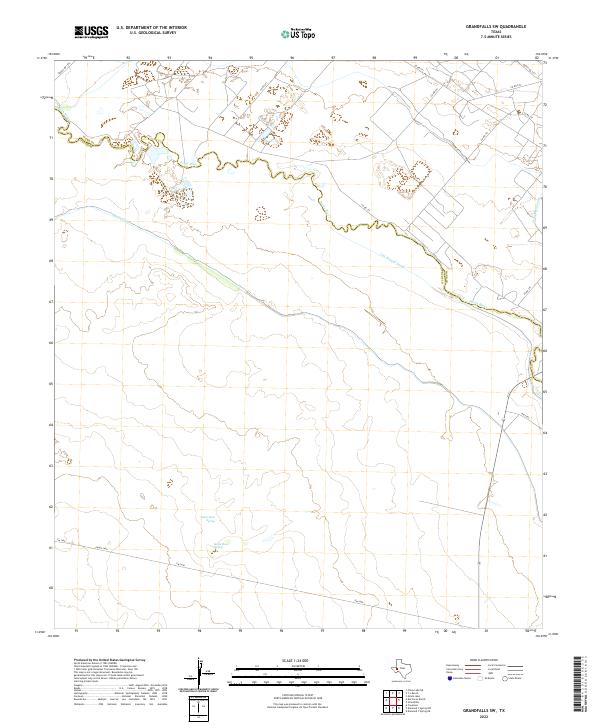
2022 Map of Grandfalls SW
USGS Topo · Published 2022About this map
The Pecos River serves as the winding centerpiece of this West Texas landscape, defining the jagged boundary of Ward Co Pecos Co. This arid region relies heavily on an intricate network of waterways for irrigation, evidenced by the presence of the Imperial Ditch, Cut Around Canal, and Grandfalls Canal. These engineered channels highlight the historical importance of water management for sustaining life and agriculture in the Trans-Pecos desert. Further south, the map identifies the Santa Rosa Spring, a vital natural water source in a territory otherwise dominated by ranch roads and open range. Key transportation routes like Fm 1450 and Ranch Rd 1776 crisscross the terrain, connecting isolated ranching operations across the county line.
Find a feature on this map
16 named features on this map. Tap any name to fly to it.
Don’t see what you’re looking for? This feature index may not catch every label — zoom into the map to look around manually.
Map Details
Editions of this 2022 Grandfalls SW Map
This is the sole edition of this map. No revisions or reprints were ever made.
Other maps of this area

1931 · Barstow
USGS Topo · 1:125,000

1954 · Pecos
USGS Topo · 1:250,000

1957 · Pecos
USGS Topo · 1:250,000

1963 · China Lake NE
USGS Topo · 1:24,000

1963 · Rio Pecos Ranch
USGS Topo · 1:24,000

1969 · Ozark Lake
USGS Topo · 1:24,000

1969 · Grandfalls
USGS Topo · 1:24,000

1969 · 7 L Ranch
USGS Topo · 1:24,000
1974 · Diamond Y Spring NE
USGS Topo · 1:24,000
1974 · Coyanosa
USGS Topo · 1:24,000